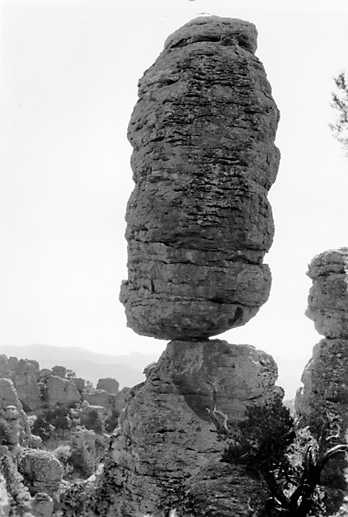
The tall stone towers for Arizona Chiricahua landscape start with violent volcanic activity about 27 million years ago. NASA Earth Observatory October 28 report use new Landsat view explain the history. From ground, the rocks fit look like separate monuments, but their origin connect to one much larger volcanic system.
Explosive eruptions scatter ash and pumice across the area. Hot flows of volcanic pieces later harden into thick layers of rock wey dem call rhyolitic tuff. As magma chamber underground empty, the ground above collapse and create Turkey Creek caldera. The landscape wey people see today develop from those materials over very long time.
Weathering and erosion gradually cut the rock into tall spires, hoodoos and deep canyons. Some carry big boulders balanced on top, while others gather close together. Apache description of the place as land of standing-up rocks fit the unusual ground, and remind people say human history dey there alongside geological history.
Landsat 9 photograph the area on July 2. Individual towers too small to distinguish for the published view from orbit. Instead, you see broad grey volcanic ridges and green valleys wey bend through them. When scientists compare this pattern with observations for ground, dem fit understand how water, plants and rocks shape the place.
Different kinds of life also make the area special. Several major ecological regions meet here, so desert plants and mountain forests dey relatively close. Chiricahua Mountains na one of Arizona isolated mountain ranges wey people call sky islands because dem rise above the surrounding low desert ground.
NASA October report also mention say the area don become national park. But the rocks important long before that administrative change. Fresh satellite picture fit record old landscape without claiming say na new discovery. The useful thing na how e show volcanic building and slow erosion working together to create today's extraordinary shapes.